How Is the Value of a Field or Agricultural Land Calculated?
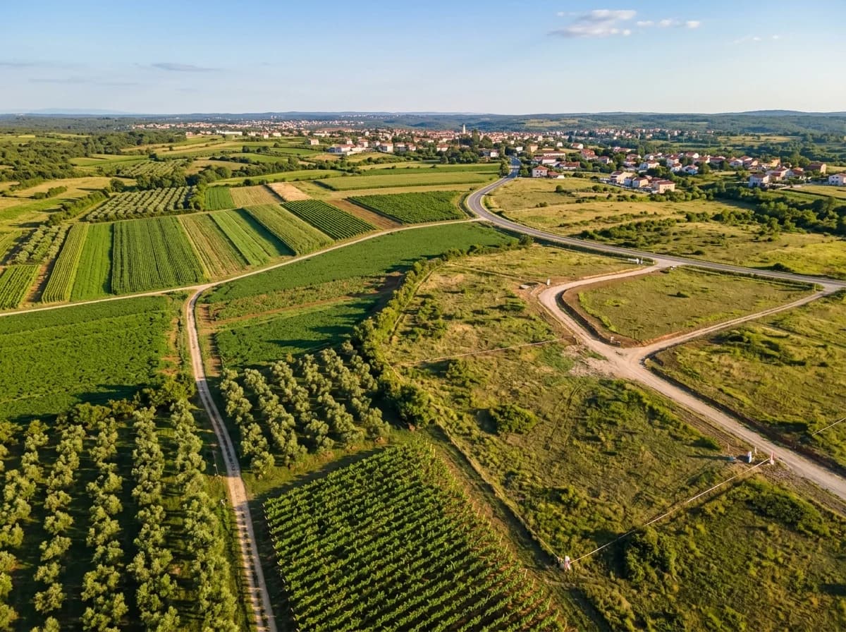
The value of a field or agricultural land is determined by its land classification, soil structure, irrigation access, parcel size, proximity to roads and settlements, and the crop potential it offers. In a valuation, sales of similar land in the immediate area are used as the basis.
Because the use of agricultural land and building on it are limited by special legislation, the legal status of the land is also examined closely in a valuation.
As with housing, regional differences in land are large: two fields of the same size can be worth very different amounts because of differences in water and road access or crop potential. Below you can find the main factors that determine value and what is examined in a valuation.
Key Takeaways
- Land classification and irrigation status are the main determinants of value.
- Parcel size and shape affect how efficiently the land can be used.
- On land with trees, the species, age and number of trees are added to the value.
- Building restrictions on agricultural land are taken into account in the valuation.
Why do land classification and soil structure matter?
Soil structure, fertility and the classification of the land determine which crop can be grown on it and how productively. Fertile, irrigated land generally carries a higher value than arid land.
The slope of the land, its stoniness, soil depth and drainage also affect how workable it is. A flat parcel suited to mechanised farming is easier to work than a sloping, terraced one. The region's climate and commonly grown crops are also taken into account in the valuation; a crop that is common and profitable in one region may not give the same return in another. Where technical documents such as a soil analysis exist, they support the valuation.
Land classification is a system that groups agricultural land by its productivity and capability for use, and the legal consequences of this classification may change under current legislation. Information on land classification should therefore be based on the records of the relevant authority, not just on the wording of a listing.
How does irrigation affect value?
Access to irrigation water increases the variety of crops that can be produced on the land and the yield. The existence and continuity of water sources such as wells, canals or an irrigation association are examined separately in the valuation.
Documenting the water right is also important: whether the well is licensed, whether the water source is sufficient throughout the year, membership of an irrigation association and the irrigation infrastructure (drip irrigation line, pump) are all things that can add value to the land or create risk. It should be remembered that water access may change according to current legislation and the conditions of the relevant authority.
The difference between irrigated and dry farming is not limited to yield; the type of crop that can be grown, the number of harvests in a year and the level of risk also change. The maintenance cost of the irrigation infrastructure and the sustainability of the water source must also be taken into account.
What is taken into account on land with trees?
On land with trees, such as olive groves, orchards or vineyards, the species, age, number and condition of the trees are added to the value. Special rules on the protection of some tree species may limit building and use options on the land.
A hypothetical example: if, of two olive groves of the same size, one has old, well-tended trees and the other has sparse, neglected trees, their values can turn out markedly different even if they are close to each other. This difference is calculated through the income potential of the trees and the cost of maintenance. Counting the trees and determining their age is mostly done through an on-site inspection.
Legal status and building
The use of agricultural land for other purposes and its subdivision are limited by legislation. Whether the land is held in shares, the encumbrances on it, and whether it falls within a zoning plan significantly affect value. The title deed record and the zoning or land-use information obtained from the relevant authorities are therefore necessary for the valuation.
Although the possibility of building on the land is thought to raise its value, the expectation of a structure for which permission cannot be obtained should not be reflected in the value. Existing unpermitted structures create legal risk and are noted separately in the report. From the buyer's point of view, it is recommended to find out in writing, before buying, for what purpose and under what conditions the land can be used.
How much do proximity to roads and settlements matter?
The ease of harvesting and transporting produce, the distance to markets and storage facilities, and whether the land fronts a stabilised or asphalt road all affect value. Parcels with no road frontage, or parcels that depend on a right of passage, may be worth less. Land close to a settlement may be priced differently because of the expectation of future zoning expansion; however, if this expectation is not based on a definite plan, it is treated with caution in the valuation.
Which method is used to value agricultural land?
The most common method in field and orchard valuation is market comparison: recent sales of similar land in the same region are compared using unit values per decare (dönüm) or per square metre. For land that produces a crop, the income approach can also be used: the annual net crop income is determined and converted into a value using an appropriate rate of return. However, because agricultural income is affected from year to year by climate, price and cost changes, the assumptions in this method should be chosen cautiously.
When using a unit value, care is taken that the parcels are comparable in terms of size, water status and road access. A small garden and a large field cannot be valued at the same unit price, so comparables are brought into line through adjustments.
Information to prepare for the valuation
The title deed record, the directions to the parcel and, if available, the cadastral sketch, the land-use type, an inventory of trees and structures, water source documents and any lease or sharecropping agreements will speed up the valuation. In inheritance or co-ownership division, the share ratios and the position of the other shareholders are also reflected in the report. If there are gaps in the documents, the expert notes this in the assumptions and limitations section of the report.
Checklist for buying agricultural land
Before buying land, check the title deed record and encumbrances, find out the land classification and permitted use, confirm the continuity of the irrigation source, examine access to roads and settlements, and find out whether the land is held in shares. If you are thinking of building, ask the relevant authorities in advance about the permits required.
Seeing the land only once, perhaps in a rainy or a dry period, can be misleading. If possible, visit in different seasons; the water situation, soil structure and road access can look very different by season. Talking to the owners of neighbouring parcels can also give you realistic information about the history of use and about irrigation rights.
Common mistakes in agricultural land valuation
Common mistakes include not checking whether the land falls within a zoning plan, leaving the trees out of the valuation, and forecasting income without confirming that the irrigation source is sufficient. These can lead to the land's real value being determined incorrectly.
Another mistake is treating agricultural land like a building plot (arsa). Building on agricultural land is subject to special rules, and it is not possible to put up a structure on every parcel. If you plan a structure such as a house or a storage building when buying land, find out in writing from the relevant authorities, before you buy, whether you will be able to obtain that permission.
How is the income approach used for agricultural land?
For land in production, the income approach can be used alongside market comparison. In this approach the land's annual output, crop sales income and production costs are assessed, and the resulting net income is converted into a value using a rate of return accepted in the market. For multi-year crops such as olive groves or orchards, the age and yield of the trees form the basis of this calculation.
The reliability of the approach depends on how realistic assumptions such as crop price, yield, water access and labour cost are. Because yield in farming can change from year to year with climate conditions, the expert looks not at a single year's data but, where possible, at an average of several years. Having this information documented (crop sales records, irrigation usage documents) strengthens the valuation.
Another factor that affects land value is parcel size and shape. On very small or irregular parcels, farming is difficult, so the unit price may be lower; large, regular parcels are suited to mechanised farming. All these factors are assessed together to determine the final value of the land, which is explained with its reasoning in the report.
Frequently Asked Questions
Last updated:
This article is for general information only; consult a valuation expert about your specific situation. Regulations and practices may change over time.
Related Services
How We Can Help You


Keep Reading